

If you are travelling to Cape Town, South Africa, a truly must-see destination is Table Mountain. I will take you through some of the essential considerations, including the weather, gear and hiking routes.
Most articles online provide you with information on hiking up table mountain in Cape Town and taking the cable car down. We opted to make the journey in the opposite direction. Table mountain in Cape Town provides a fantastic mix of adventure and nature activities, and this is just one of the ways to appreciate this magnificent natural wonder.
Taking the Cable Car up
The cableway on table mountain is one of South Africas most popular attractions. The Table Mountain Aerial Cableway offers many exclusive offers such as birthday free rides, student discount on Fridays, senior citizen discounts as well as kids promotions at specific times during the year. If you make use of the specials, you can not purchase the tickets online. It may be worth your while to check out the particulars before you go. My trip coincided with my birthday, and I thus scored this ride free.
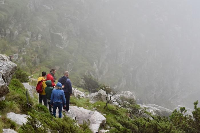
Check Out the Weather First
As Cape Town has relatively unpredictable weather, it is critical that you check out the weather ahead of planning your hike. Most locals have advanced weather apps on their phones that include wind speed and other key indicators such as Windy.
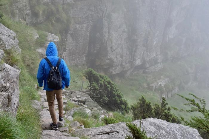
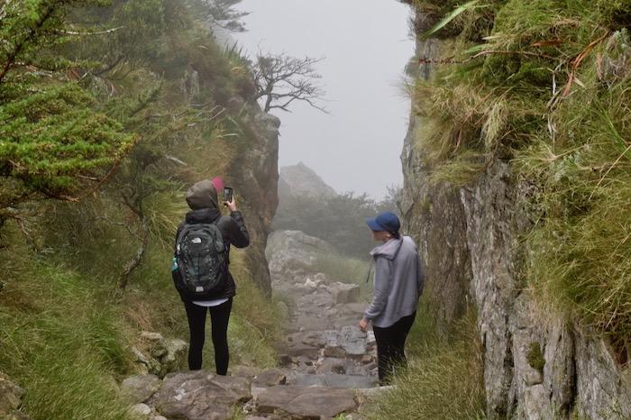
We slipped up on this slightly, we did check the weather and noticed some clouds; however, on the day as you will see in the photos cloud cover restricted our view. We had to make some safety decisions to hike or not hike but decided to go ahead as planned.
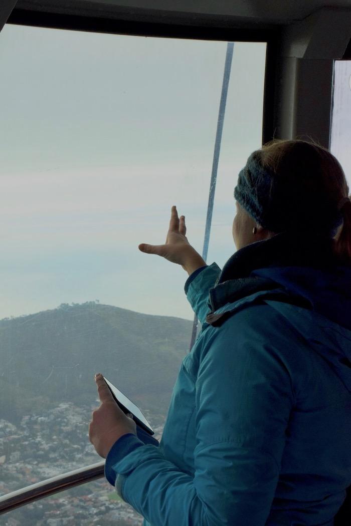
The Table Mountain Aerial Cableway
The cablecar revolves 360 degrees to give every tourist an opportunity at the view. It can take 65 passengers, so our wait was not too long. The ascent is quite rapid taking you up the announced 1067m hight very quickly. At the top, you will find some great gift shops and restaurants to stock up on fuel before you take the hike down.
The cablecar revolves 360 degrees to give every tourist an opportunity at the view. It can take 65 passengers, so our wait was not too long. The ascent is quite rapid taking you up the announced 1067m hight very quickly. At the top, you will find some great gift shops and restaurants to stock up on fuel before you take the hike down.
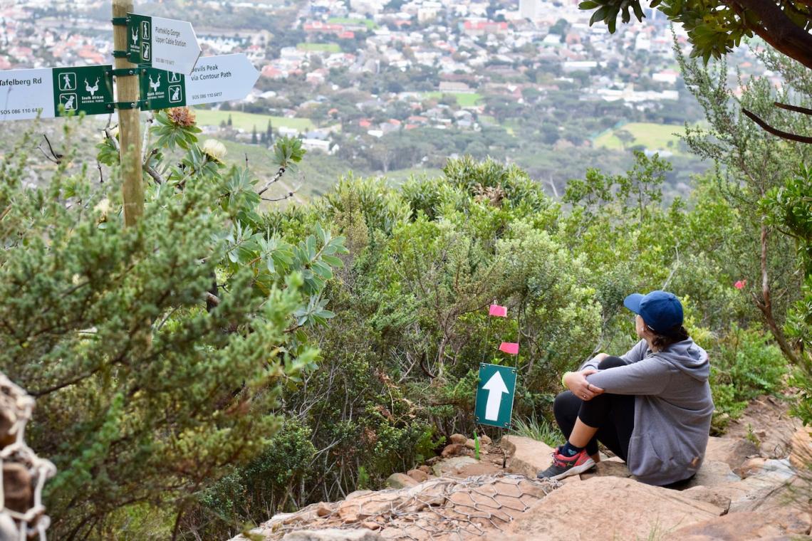
The Directions Down - Platteklip
We took the Platteklip Hike down, which is the advised route for most tourists. Other routes exist but has a higher level of difficulty and would involve some climbing. The Platteklip path is very well marked and very popular so you should not have too much of a problem following it down the mountain. The natural rock has been formed into step like paths to keep you on track.
We took the Platteklip Hike down, which is the advised route for most tourists. Other routes exist but has a higher level of difficulty and would involve some climbing. The Platteklip path is very well marked and very popular so you should not have too much of a problem following it down the mountain. The natural rock has been formed into step like paths to keep you on track.
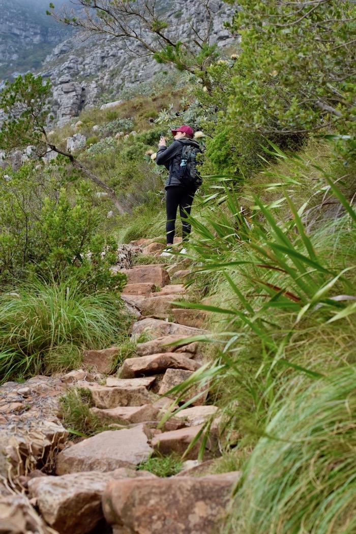
Ask an employee at the top to direct you to the Platteklip route; make sure not to take the India Venster route. Once you see India Venster walk a little further to find Platteklip. The Platteklip way takes you through a very scenic meandering path under Maclear's Beacon.
What you need to bring
Do not be fooled by the popularity of the hike; it is still a mountain, and it is essential to have the right equipment for safety and comfort.
- Water at least 1L
- Comfortable walking or hiking shoes
- Backpack with something warm
- Throw away poncho in case of rain
- Hikers first aid kit
- Cell phone & head torch
- Hat and sunscreen
- Some snacks
- Bag for your trash
Safety First & Important Information
- Table Mountain Emergency Number 0861106417
- The last cable car down is at 6 pm do not leave too late
- Hike in a group or at least with a buddy
- The trail allows dogs, but they need to be on a leash
- Be conscious of the areas being rehabilitated and don't leave any trash behind
The bottom of the trail will bring you to the Platteklip information station. Before you take the cable car up you can park here, or you will have to take a 1km walk to the Cableway parking.
Published at ConservationMag here.